
Scenic Views · Camping & Hiking · Quebec
Pic de l'Ours
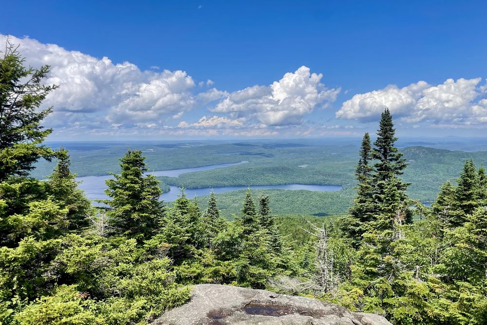
A 740 m summit on the Sentier des Crêtes in Parc national du Mont-Orford, with big views over the Eastern Townships. A rooty, rocky climb that suits fit hikers.
Scenic Views · Camping & Hiking · Quebec
A 740 m summit on the Sentier des Crêtes in Parc national du Mont-Orford, with big views over the Eastern Townships. A rooty, rocky climb that suits fit hikers.
Pic de l'Ours is one of the peaks along the Sentier des Crêtes in Parc national du Mont-Orford, near Eastman. From the ridge, hikers look out over the Eastern Townships and, according to Sépaq, the mountains of Vermont. Several reviewers say the open ridgeline is the best part of the day, and one recommends it at sunset.
It's an out-and-back hike on technical ground, with roots, big rocks, some scrambling and mud. French- and English-speaking reviewers agree it takes strong legs going up and solid knees coming down. Most rate it intermediate, and one hiker who started at Lac Stukely reached the summit in about two and a half hours, about 11 km return. Plan on four to seven hours for the full ridge.
The trails are well marked and well maintained, and hikers enjoy the fern-scented woods and birdlife on the way. It gets busy in summer and fall. One hiker found the parking lot named for the peak unavailable and walked an extra 2 km on the bike path from a lower lot, with no toilets at that start, so check Sépaq's trailhead information first.
Wear hiking boots, bring plenty of water, and leave time to rest. As a summit hike with no water access, it's not a fishing spot.
Summarised from visitor reviews on Google Maps. Based on 52 Google reviews. Conditions and rules change — check current park, access and fishing regulations before you go.