
Scenic Views · Saskatchewan
Conglomerate Cliffs
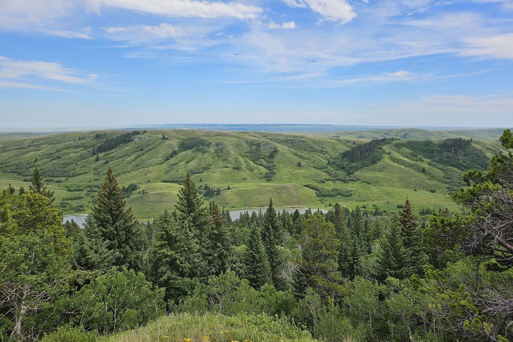
A clifftop viewpoint in the West Block of Cypress Hills Interprovincial Park, SK, with wide valley views near Fort Walsh. The last stretch is gravel and dirt, so avoid it in wet weather.
Scenic Views · Saskatchewan
A clifftop viewpoint in the West Block of Cypress Hills Interprovincial Park, SK, with wide valley views near Fort Walsh. The last stretch is gravel and dirt, so avoid it in wet weather.
The Conglomerate Cliffs are a band of cobblestone rock in the West Block of Cypress Hills Interprovincial Park, cemented together over a very long time into what one visitor compared to exposed-aggregate concrete. From the top you look out over a wooded valley, Adams Lake and rolling hills beyond. Reviewers are close to unanimous that the view is worth the trip, and one noted that it explains why early promotion of the hills borrowed the word fjords.
The road ends at a plateau above the cliffs with plenty of parking, and it's an easy walk around the edge. A few short paths lead down so you can see the face of the cliffs from below, and there are informal trails to wander. Visitors in summer mention wildflowers, and several suggest bringing binoculars and a camera for the panorama.
Most people pair the cliffs with Fort Walsh National Historic Site, which sits just beside the West Block, and make a day of it. The West Block is the quieter, more rustic side of the Saskatchewan park, so it suits travellers who don't mind a bit of gravel and want a less busy stop than the Centre Block.
Getting there is the main caveat. The last kilometre or so is dirt, which is fine when dry but not when it's wet; Tourism Saskatchewan notes the road and trail aren't accessible in wet conditions. One visitor had no trouble in a small car, while another who followed map directions from the Centre Block ended up on rough roads through fenced private land. Stick to the signed route off Highway 271 rather than trusting a phone shortcut.
Summarised from visitor reviews on Google Maps. Based on 53 Google reviews. Conditions and rules change — check current park, access and fishing regulations before you go.